Big Data in Earth Systems
Computational geoscience at scale — turning satellite, geophysical and sensor data into physically consistent, explainable forecasts.
- 2
- Deep-learning frameworks
- 4
- Data streams
- 3
- Open-source tools
- INP-HB
- Teaching
XTFT · GeoPriorSubsNet
InSAR · EM · ERT · boreholes
GeoPrior-v3 · FusionLab · k-diagram
Computational geosciences
What this axis covers
Three strands that together turn Earth data into knowledge others can use.
Earth data at scale
Multi-year InSAR time series, electromagnetic and resistivity surveys, borehole and hydrological records — harmonised into reproducible pipelines.
Physics-informed & explainable AI
Attention-based forecasters and physics heads that respect hydrogeology, so predictions stay physically consistent and interpretable.
Teaching & open science
Computational geosciences taught at INP-HB, backed by open-source packages and documentation anyone can reuse.
Data-Driven Learning
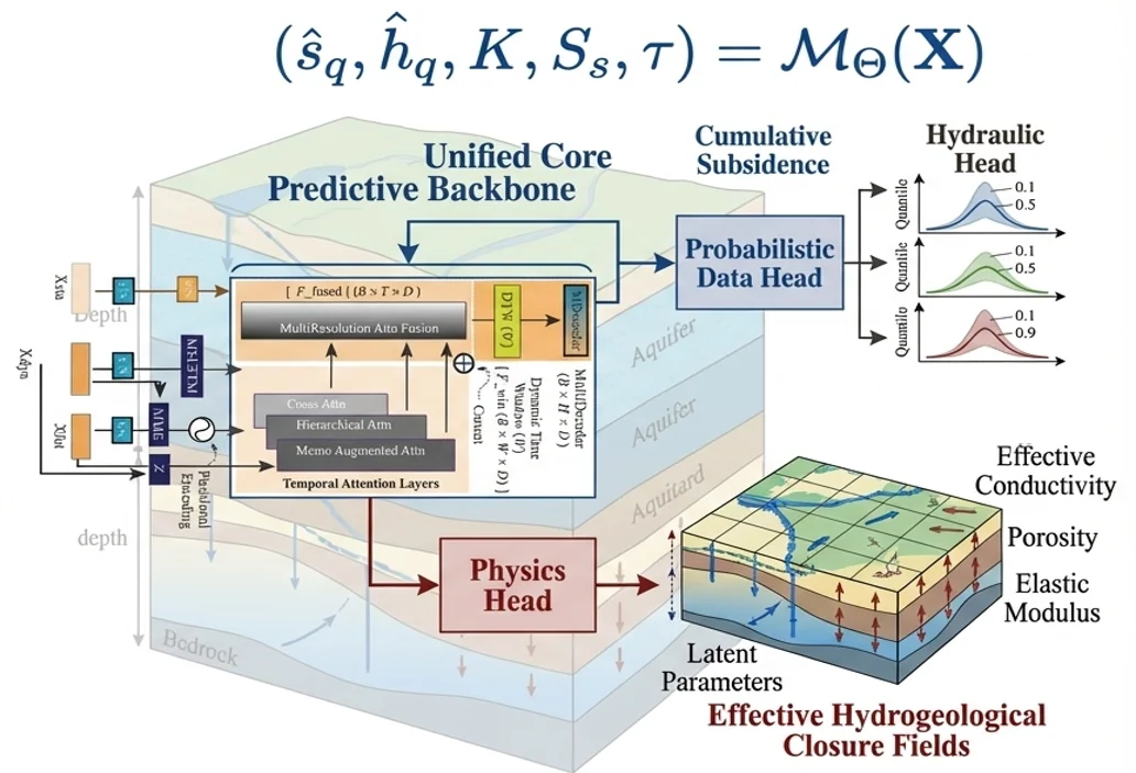
Multi-resolution attention fusion and encoder-decoder backbones that learn complex spatiotemporal patterns from InSAR, piezometric, and geological datasets.
Physics Heads
Dedicated physics head in GeoPriorSubsNet v3 recovers latent hydrogeological parameters — effective conductivity, porosity, elastic modulus — without extra supervision, enforcing physical plausibility at output time.
GeoPriorSubsNet v3: A Case Study in Physics-Guided AI
GeoPriorSubsNet v3 unifies a probabilistic data head (quantile outputs for cumulative subsidence and hydraulic head) with a physics head that recovers effective hydrogeological closure fields — conductivity, porosity, and elastic modulus — as latent variables. Trained on multi-city InSAR and piezometric data, it outperforms purely data-driven baselines and transfers across cities with minimal retraining.
The physics head acts as an implicit regularizer — it forces the model to learn representations that remain physically meaningful even under distribution shift across cities.
Uncertainty-Aware Evaluation
GeoPriorSubsNet's probabilistic outputs are audited with the k-diagram toolkit — ensuring that physical plausibility and statistical reliability go hand in hand across all quantile levels.
- Are physics-constrained forecasts better calibrated than data-only baselines?
- Do physics heads reduce physically implausible predictions?
- Where do data-physics trade-offs emerge in multi-city transfer?
From Research to Practice
GeoPrior-3.0 Forecaster brings GeoPriorSubsNet to practitioners who don't write code — a desktop GUI that covers the full pipeline from data intake and physics-constraint configuration to training, transfer learning, and operational forecasting.
Product pageKey research outcomes
What this line of work has produced so far.
- 8+
Publications
Spanning deep-learning forecasting, physics-informed AI and data-driven geophysics, in JEM, EMS, Computers & Geosciences and JOSS.
- 2
Deep-learning frameworks
XTFT and GeoPriorSubsNet — architectures with probabilistic and physics heads for Earth-system forecasting.
- 3
Open-source tools
GeoPrior-v3, FusionLab-learn and k-diagram — installable Python packages with reproducible tutorials.
- 1
Desktop product
GeoPrior-3.0 Forecaster brings the full pipeline to practitioners who don't write code.
Software & documentation
Open-source tools that put this research into practice.

GeoPrior-v3
Scientific Python framework for physics-guided geohazard analysis, forecasting, and risk-oriented interpretation.

FusionLab-learn / XTFT
Flexible forecasting framework centered on TFT and XTFT variants for calibrated, uncertainty-aware time-series modeling.
GeoPrior-3.0 Forecaster
A guided desktop environment for operationalizing GeoPrior-v3 from data intake to reproducible geohazard forecasting.
Related publications
Peer-reviewed papers and preprints from this line of research.
- 2024Published
Machine learning-based techniques for land subsidence simulation in an urban area
Liu, J.; Liu, W.; Allechy, F. B.; Zheng, Z.; Liu, R.; Kouadio, K. L.*
Journal of Environmental Management
Read paper - 2025Published
A mixture learning strategy for predicting aquifer permeability coefficient K
Kouadio, K. L.; Liu, J.; Liu, W.; Liu, R.
Computers & Geosciences
Read paper - 2024Published
K-Means Featurizer: A Booster for Intricate Datasets
Kouadio, K. L.; Liu, J.; Liu, R.; Wang, Y.; Liu, W.
Earth Science Informatics
Read paper - 2023Published
Ensemble Learning Paradigms for Flow-Rate Prediction Boosting
Kouadio, K. L.; Liu, J.; Kouamelan, S. K.; Liu, R.
Water Resources Management
Read paper - 2023Published
watex: machine learning research in water exploration
Kouadio, K. L.; Liu, J.; Liu, R.
SoftwareX
Read paper - 2026Under Review
Physics-Informed Deep Learning Reveals Divergent Urban Land Subsidence Regimes
Kouadio, K. L.; Liu, R.; Liu, Z.; Jiang, S.; Kouamelan, S.; Liu, W.; Qing, Z.; Zheng, Z.
IEEE Transactions on Geoscience and Remote Sensing
Continue exploring
Each area feeds into the others — here is where to go next.
Natural Hazards
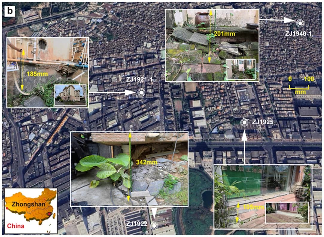
Land subsidence, contamination from failing landfills and wildfires threaten cities, water and ecosystems — often faster than monitoring can follow.
Explore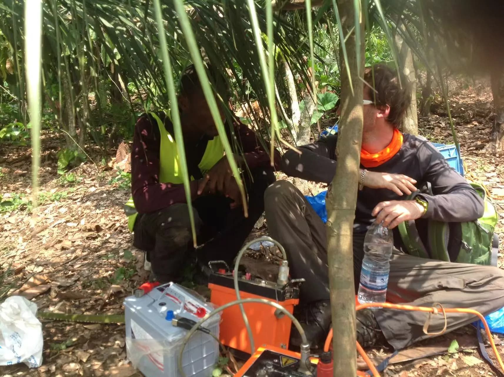
Groundwater & Mineral Exploration
Finding water and mineral resources where data are scarce remains costly and uncertain.
Explore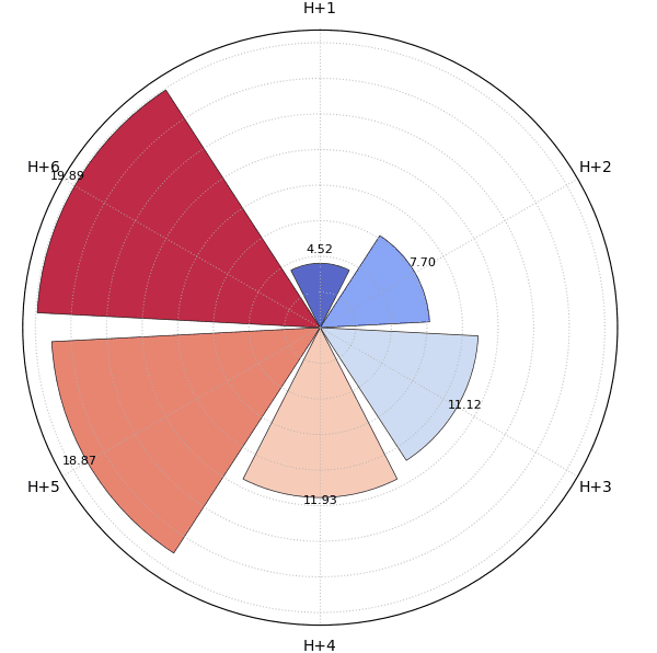
Uncertainty & Trustworthy Forecasting
Making reliable decisions requires a trustworthy understanding of forecast uncertainty.
Explore