Uncertainty & Trustworthy Forecasting
Building the tools to make probabilistic forecasts trustworthy, auditable, and actionable.
- 100+
- Plot functions
- 2
- New frameworks
- JOSS
- Peer-reviewed tool
- 4+
- Publications
Covering bias, sharpness, calibration and reliability in one toolkit.
Cluster-Aware Severity scoring and k-diagram diagnostics for judging probabilistic forecast quality.
2025
JOSS · EMS
The Problem
Most forecasting models produce uncertainty estimates, but few practitioners know how to interpret them. Coverage gaps, overconfidence, and poor calibration go undetected — leading to decisions based on false confidence.
The Innovation
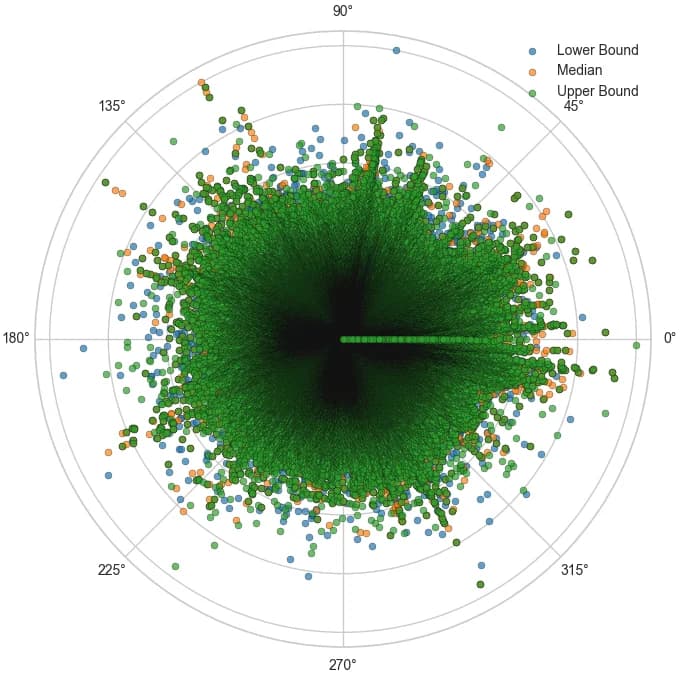
The k-diagram framework introduces a polar coordinate system for visualizing multiple dimensions of forecast quality simultaneously — coverage, calibration, severity, and reliability — in a single, interpretable chart.
A Concrete Application: Subsidence Forecasting
How k-diagram diagnostics improved real-world model evaluation
- 1
Generate Forecasts
Run XTFT or PINN-based model to produce probabilistic subsidence predictions with confidence intervals.
- 2
Apply k-Diagram
Feed predictions into the k-diagram toolkit to produce polar diagnostic plots across all coverage levels.
- 3
Interpret & Improve
Identify coverage gaps, overconfident intervals, or systematic biases and retrain accordingly.
What Can k-Diagram Answer?
The k-diagram toolkit turns abstract uncertainty metrics into visual diagnostics.
“Is my model well-calibrated?”
Visualize whether prediction intervals actually contain the true value at the stated confidence level.
“Where does coverage fail?”
Identify specific coverage levels or time horizons where the model systematically under- or over-predicts.
“How severe are the errors?”
Quantify the magnitude of coverage gaps and their potential impact on downstream decisions.
Key research outcomes
What this line of work has produced so far.
- 4+
Publications
JOSS, Environmental Modelling & Software and work under review on probabilistic diagnostics and cluster-aware scoring.
- 1
Peer-reviewed tool
k-diagram, published in the Journal of Open Source Software (2025) with documentation and reproducible examples.
- 2
New frameworks
Cluster-Aware Severity scoring and k-diagram diagnostics for judging probabilistic forecast quality.
- 100+
Plot functions
Covering bias, sharpness, calibration and reliability in one toolkit.
Software & documentation
Open-source tools that put this research into practice.
k-diagram
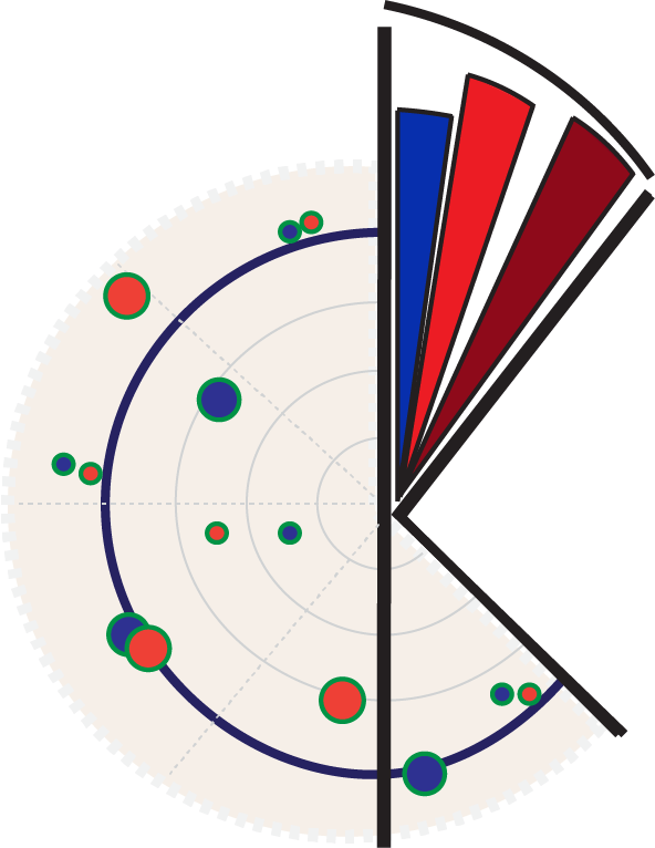
Polar diagnostics toolkit for forecast uncertainty, coverage, calibration, and severity.
Related publications
Peer-reviewed papers and preprints from this line of research.
- 2024Published
Machine learning-based techniques for land subsidence simulation in an urban area
Liu, J.; Liu, W.; Allechy, F. B.; Zheng, Z.; Liu, R.; Kouadio, K. L.*
Journal of Environmental Management
Read paper - 2026Published
A diagnostic framework for interpreting spatiotemporal probabilistic forecasts
Kouadio, K. L.; Liu, R.; Loukou, K. G. H.; Liu, W.; Qing, Z.; Liu, Z.
Environmental Modelling & Software
Read paper - 2025Published
k-diagram: Technical Report — Derivations and Details
Kouadio, K. L.
Zenodo
Read paper - 2025Published
k-diagram: Rethinking Forecasting Uncertainty via Polar-Based Visualization
Kouadio, K. L.
Journal of Open Source Software
Read paper - 2025Under Review
XTFT: A Next-Generation Temporal Fusion Transformer for Uncertainty-Rich Time Series Forecasting
Kouadio, K. L.; Liu, Z.; Liu, R.; Bizimana, P. C.; Yang, G.; Liu, W.
IEEE TPAMI
Read paper - 2025Under Review
Cluster-Aware Severity: Diagnosing Bursts of Prediction-Interval Violations
Kouadio, K. L.; Liu, R.
Information Sciences
Continue exploring
Each area feeds into the others — here is where to go next.
Big Data in Earth Systems
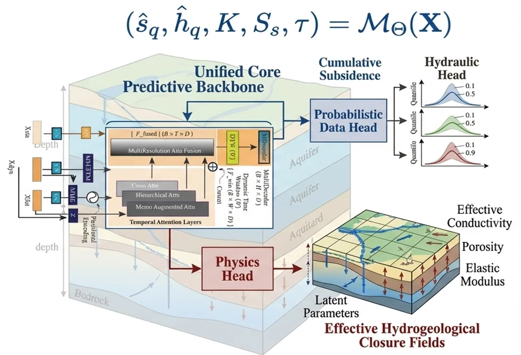
Satellites, geophysical surveys and sensor networks produce far more data than traditional geoscience workflows can turn into insight.
Explore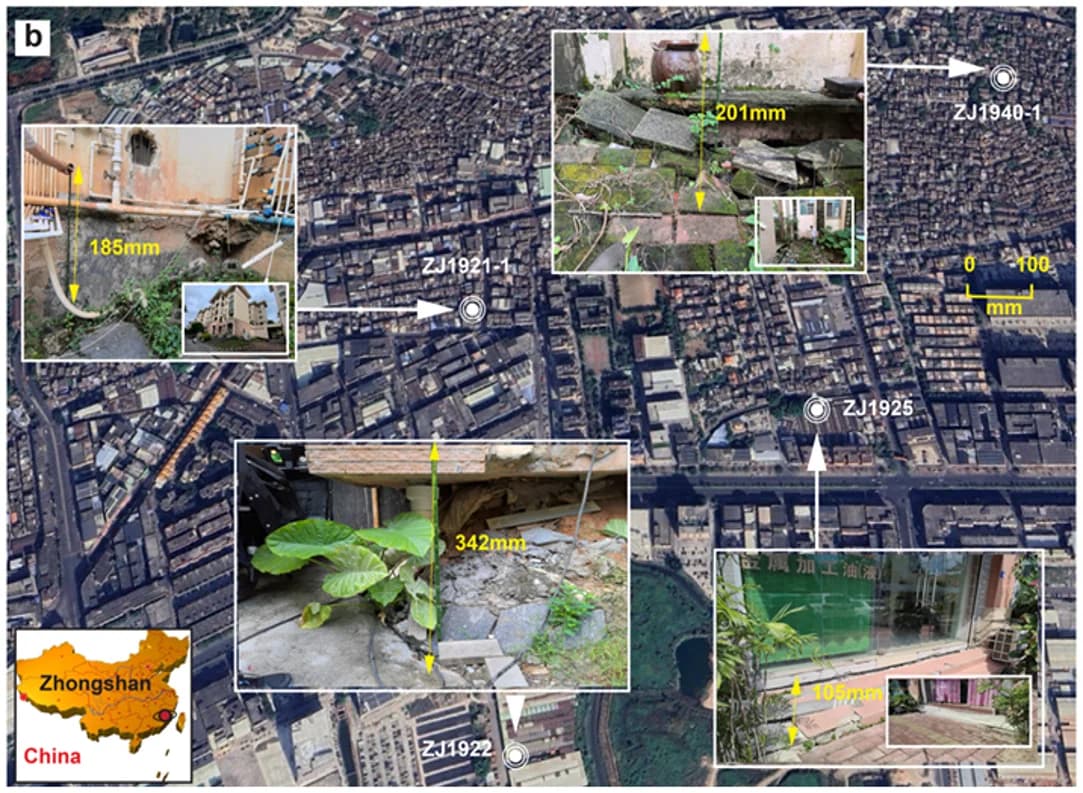
Natural Hazards
Land subsidence, contamination from failing landfills and wildfires threaten cities, water and ecosystems — often faster than monitoring can follow.
Explore
Groundwater & Mineral Exploration
Finding water and mineral resources where data are scarce remains costly and uncertain.
Explore